
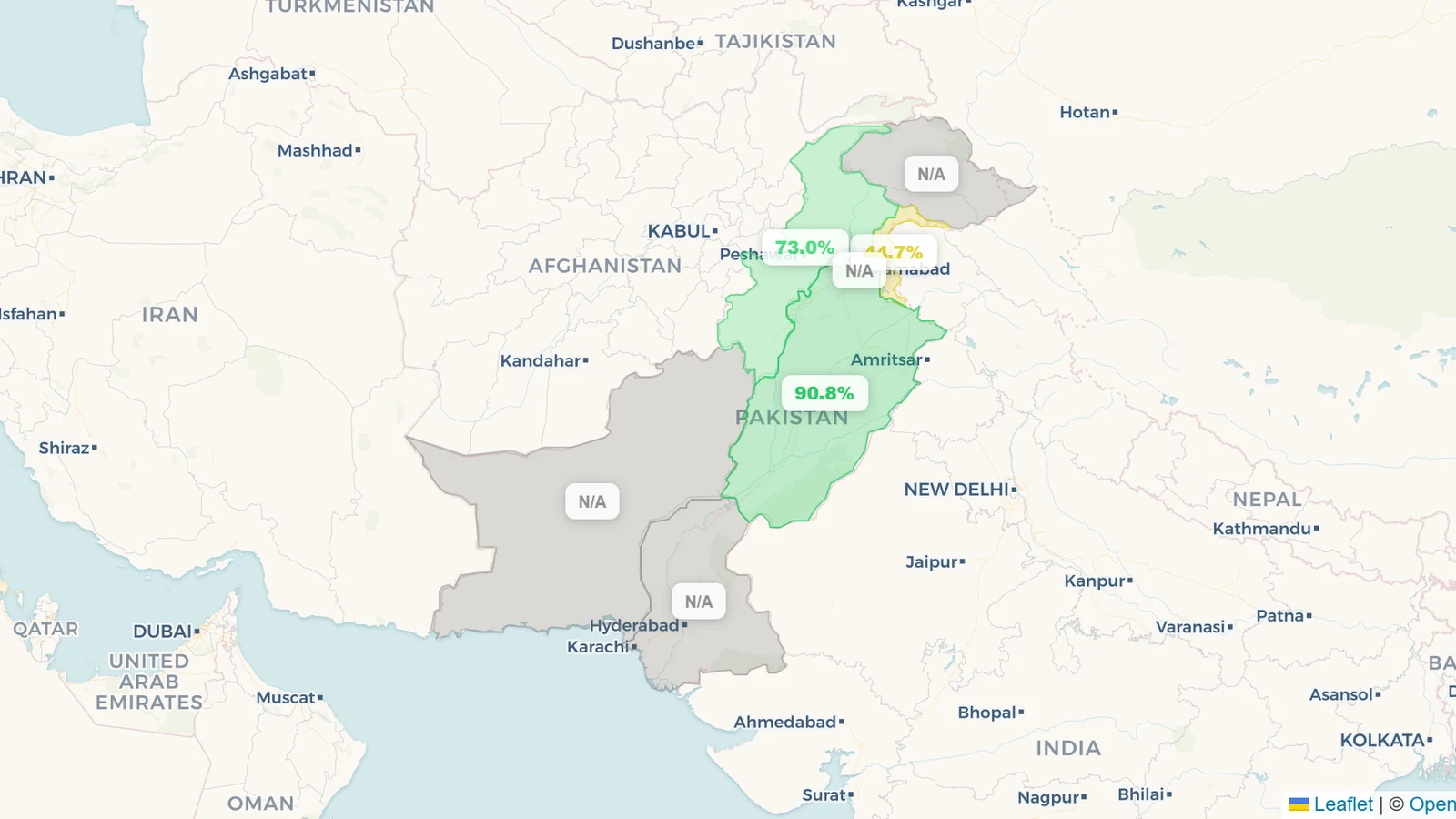
Pakistan's three big federal reservoirs are about 68% full as of 11 July 2026, holding roughly 15.6 of a possible 23.1 km³ — but the single national figure hides the year's central fact: the monsoon has arrived hard on the Indus and barely at all on the Jhelum. Tarbela, the giant on the Indus, has filled from about 23% on 26 June to 73% on 11 July — a 50-point rise in a fortnight that has pushed it above its usual July level. Mangla, the second reservoir, on the Jhelum, has hardly moved: at 44.7% it sits some 25 points below its July norm, its catchment still waiting for the rain. The third, Chashma, is a run-of-river barrage that swings by the day and currently reads ~91%. All figures are from IRSA, the Indus River System Authority; the live dashboard is on the Pakistan page.
Key takeaways
- National storage is ~68% of capacity (11 July 2026) — about 15.6 of 23.1 km³ across Tarbela, Mangla and Chashma, capacity-weighted. Live figures on the Pakistan page.
- Tarbela is filling fast and above normal. The Indus reservoir jumped from ~23% (26 June) to 73% (11 July), overtaking its ~62% July norm — a textbook monsoon fill on the upper Indus.
- Mangla is the laggard. On the Jhelum, Mangla is at 44.7% against a ~70% July norm and is barely rising week to week — the Jhelum catchment has yet to deliver its monsoon inflow.
- One country, two rivers, two stories. The gap between a fast-filling Indus and a stalled Jhelum is the whole picture this July, and it is why the national average sits in between.
- Chashma is pondage, not storage. Chashma is a barrage on the Indus that cycles between ~20% and ~90% within days as flow passes through; its high reading is not "water banked," just water in transit.
Where the data comes from
Pakistan publishes its reservoir levels through IRSA (the Indus River System Authority), whose daily report covers the three major multipurpose storages on the Indus River System — Tarbela, Mangla and Chashma — operated by WAPDA. Those three are the country's public reservoir picture: the rest of Pakistan's water is moved by barrages and run-of-river canal systems that divert flow rather than store it, or by smaller dams with no publicly accessible volumetric data. reservoirs.earth mirrors IRSA's daily readings, keeps the multi-year history, and rolls the three reservoirs up to a national figure weighted by capacity. Every number here is dated, because these levels change daily during the monsoon; the live dashboard and each reservoir's chart are on the Pakistan page. Pakistan's data openness is scored in the Reservoir Transparency Index.
The current picture (as of 11 July 2026)
| Reservoir | River / basin | Fill | July norm | vs norm |
|---|---|---|---|---|
| Tarbela | Indus | 73.0% | ~62% | +11 |
| Mangla | Jhelum | 44.7% | ~70% | −25 |
| Chashma | Indus barrage | 90.8% | ~70% | — |
Two of the three lines tell the story. Tarbela — one of the largest earth-filled dams in the world, and the anchor of Pakistan's hydropower and irrigation — came into July unusually low, near 23%, then filled to 73% in two weeks as the monsoon swelled the Indus. Mangla, 200 km east on the Jhelum, saw none of that: it is essentially flat and 25 points under its July norm. Chashma's ~91% belongs in a different category — it is a barrage, a pondage structure whose level rises and falls with daily flow, not a storage reservoir, so its percentage should be read as "flow passing through," not "reserve banked."
Two rivers, two monsoons
Pakistan's reservoir system sits on two great tributaries of the Indus basin, and this July they are on different clocks. The Indus rises in the Karakoram and Tibet and is fed by both snowmelt and the monsoon striking the mountains of Khyber Pakhtunkhwa and Gilgit-Baltistan; that is the water now pouring into Tarbela. The Jhelum, which fills Mangla, drains the mountains of Azad Jammu & Kashmir, and its monsoon has been late and light so far — leaving Mangla to start the wet season from behind.
The split matters because the two reservoirs do different jobs. Tarbela is the bigger hydropower and Kharif-season irrigation store; a fast fill there eases both power supply and the summer-crop water that Punjab and Sindh draw downstream. Mangla, raised in 2009 to add storage, is the buffer on the Jhelum; a below-normal Mangla in mid-July is the kind of detail that tightens allocation decisions later in the season if the Jhelum's rains stay shy. IRSA's job is precisely to divide this water between provinces, and a lopsided fill — one river ahead, one behind — is what makes those calls contentious.
Why the trajectory matters more than the level
For a monsoon-fed system, mid-July is not the finish line; it is the start of the climb. Both reservoirs bottom out in spring and are supposed to fill through July, August and into September — Tarbela's seasonal peak norm is around 95% in September, Mangla's around 93%. Read that way, the two reservoirs are sending opposite signals about the same monsoon: Tarbela is running ahead of the curve, while Mangla is running well behind it with the same weeks left to catch up.
That is the number to watch over the coming fortnights, and it rhymes with what is happening one border east, where India's monsoon has flipped its western reservoirs from drawdown to fast refill (see the India monsoon tracker). The monsoon that fills Maharashtra's Western Ghats dams and the upper Indus is the same system; whether it turns north-west onto the Jhelum in the next few weeks is what decides Mangla's season.
What reservoir levels do — and don't — tell you here
- The national average is a blend, not a description. At ~68% it sits between a full-and-rising Indus store and a half-empty Jhelum one; neither reservoir is actually at 68%. The useful figures are Tarbela and Mangla read separately.
- A barrage percentage isn't storage. Chashma can read 90% one week and 30% the next; it regulates flow rather than banking water, so it shouldn't be averaged in the head with the two big dams.
- Timing sets the meaning. 73% at Tarbela in mid-July is strong because the reservoir is still climbing toward a September peak; the same 73% in October would read as a drawdown. Watch each reservoir against its own seasonal curve.
- Three reservoirs are not the whole country. IRSA's public data covers the major Indus-system storages; Pakistan has many more dams and barrages, particularly in Khyber Pakhtunkhwa and Balochistan, with no public volumetric figures — so this is the storage that is measured and shared, which is exactly what the transparency index is about.
This is a July 2026 snapshot of Pakistan; the same monsoon is playing out next door in the India monsoon tracker and across India's reservoirs. How Pakistan's water-data openness ranks is on the Reservoir Transparency Index.