Chashma Barrage
Punjab · Indus
Capacity
261 hm³
Coordinates
32.452°N, 71.386°E
Operator
WAPDA
81.6% full
Current fill
81.6%vs 7 days ago
+27.7%gaining
vs 1 year ago
+5.6%year-over-year
7-day trend
↑rising
Catchment Weather
Past 30 days + 14-day forecast · Open-Meteo
Technical specifications
| Total capacity | 261 hm³ |
| Usable capacity | 231 hm³ |
| Dam height | 15 m |
| Dam type | Barrage |
| Year built | 1971 |
| Primary use | Irrigation |
| Operator | WAPDA |
| River | Indus |
| Province | Punjab |
| River basin | Indus |
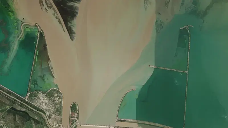
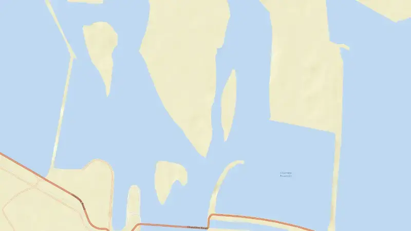
Satellite imagery: Esri, Maxar, Earthstar Geographics. Map: Esri, HERE, Garmin, © OpenStreetMap contributors. 32.452, 71.386 · Open in Google Maps
About Chashma Barrage
As of July 28, 2026, Chashma Barrage is filled to 81.6% of its total capacity, holding roughly 218 hm³ of water out of a maximum 261 hm³. At this level the reservoir is high. Of that total, about 231 hm³ is usable (live) storage.
Over the most recent week on record the fill level has risen by 27.7 percentage points, and it is 5.6 points above its level on the same date a year earlier.
Across the readings we hold for Chashma Barrage — 71 data points between May 18, 2026 and July 28, 2026 — the level has ranged from a low of 18.0% (June 26, 2026) to a high of 93.5% (July 14, 2026).
The dam at Chashma Barrage stands 15 m tall and is a barrage dam and was completed in 1971. It is operated by WAPDA primarily for irrigation. It lies within the Indus basin at 32.452°N, 71.386°E.
Key facts
- Current fill level
- 81.6%
- Water stored
- 218 hm³
- Total capacity
- 261 hm³
- Usable capacity
- 231 hm³
- 7-day change
- ▲ 27.7 pts
- Year-on-year
- ▲ 5.6 pts
- Primary use
- Irrigation
- River
- Indus
- River basin
- Indus
- Dam height
- 15 m
- Year completed
- 1971
- Operator
- WAPDA
- Coordinates
- 32.452°N, 71.386°E
- Last updated
- July 28, 2026
Recent readings
| Date | Fill level | Volume (hm³) |
|---|---|---|
| 28 Jul 2026 | 81.6% | 218 |
| 27 Jul 2026 | 53.9% | 155 |
| 26 Jul 2026 | 60.4% | 170 |
| 25 Jul 2026 | 67.7% | 187 |
| 24 Jul 2026 | 67.7% | 187 |
| 23 Jul 2026 | 67.7% | 187 |
| 22 Jul 2026 | 67.7% | 187 |
| 21 Jul 2026 | 56.7% | 161 |
| 20 Jul 2026 | 39.2% | 121 |
| 19 Jul 2026 | 31.8% | 104 |
| 18 Jul 2026 | 41.9% | 127 |
| 17 Jul 2026 | 63.1% | 176 |
Frequently asked questions
What is the current water level of Chashma Barrage?
As of July 28, 2026, Chashma Barrage is at 81.6% of its capacity, holding approximately 218 hm³ of water, according to IRSA – Indus River System Authority data.
Is Chashma Barrage reservoir full?
No. As of July 28, 2026, Chashma Barrage is high at 81.6% of its capacity, so it is not full.
Is the water level at Chashma Barrage rising or falling?
The level at Chashma Barrage is rising — it gained 27.7 percentage points over the latest week on record.
How much water can Chashma Barrage hold?
Chashma Barrage has a total capacity of 261 hm³, of which about 231 hm³ is usable storage.
Where is Chashma Barrage reservoir located?
Chashma Barrage is located in Punjab, Pakistan, within the Indus basin (coordinates 32.452°N, 71.386°E).
When was Chashma Barrage dam built?
The dam at Chashma Barrage was completed in 1971.
What is Chashma Barrage used for?
Chashma Barrage is used primarily for irrigation, and is managed by WAPDA.