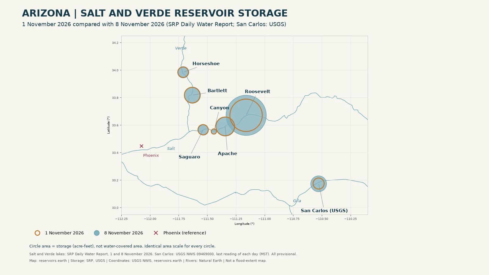
Salt River Project's Daily Water Report put its Salt and Verde reservoir system at 53% full, 1,220,559 acre-feet, on 1 November 2026, and at 70% full, 1,603,659 acre-feet, on 6 November. The latest report, dated 8 November, shows 71% full and 1,616,429 acre-feet. Roosevelt Lake held 677,992 acre-feet on 1 November and 1,048,417 acre-feet on 8 November. All figures are provisional SRP observations. For today's Roosevelt reading, see the Roosevelt Lake water level page.
What this comparison measures
This is a comparison of stored water on dated reports. It is not a calculation of how much rain became reservoir inflow. Storage also moves with releases and operating decisions, and SRP released large volumes during the event. The figures cannot show that all of an increase came from one storm, or that a reservoir prevented a particular flood downstream.
The baseline is SRP's Daily Water Report for 1 November 2026, the date SRP itself uses as the starting point. The comparison dates are 6 November, the date of SRP's press release, and 8 November, the latest report published when this article was checked. Each report is opened by its own dated address (reportDate=YYYY-MM-DD). Storage is given to the nearest acre-foot, as SRP prints it. A percentage full appears only where SRP prints it on that report. There is no calculated-change column and no projection.
Key takeaways
- SRP's total reservoir system went from 53% full on 1 November to 70% on 6 November, according to both the Daily Water Report and SRP's 6 November release. The 8 November report shows 71%.
- SRP says it stored "about 370,000 acre-feet of water or 120 billion gallons" from the storms. That is SRP's figure, not one derived here.
- Roosevelt Lake held the most water of the six SRP lakes on every date in the comparison: 677,992 acre-feet (41%) on 1 November and 1,048,417 acre-feet (64%) on 8 November.
- The two Verde lakes rose: Bartlett from 89% to 95% and Horseshoe from 65% to 76% between 1 and 8 November. Apache, Canyon and Saguaro, the smaller lakes below Roosevelt, held close to their 1 November levels.
- San Carlos Reservoir on the Gila is not an SRP lake. USGS recorded 79,080 acre-feet late on 1 November and 163,200 acre-feet late on 8 November.
- These are provisional storage records, not flood maps, safety assessments or forecasts.
The runoff event
SRP's 6 November release gives the peaks: inflows into Roosevelt Lake of about 145,000 cubic feet per second (cfs) and inflows on the Verde River of about 94,000 cfs. SRP describes October and November inflows on the Salt and Verde watershed as "the highest on record" and "about eight times greater than average".
To manage those flows, SRP released about 54,000 cfs from Bartlett and Stewart Mountain dams, according to the same release. The Daily Water Report for 1 November warned that combined releases would move through the Phoenix area toward the Gila River and were "likely to exceed 54,000 CFS". It told the public to avoid river channels, banks, low-level crossings and recreation areas along the Verde and Salt, and said several East and West Valley roads would close. By the 6 November report, SRP stated that flows from the reservoir system had "returned to the normal operating range".
News reporting covers road closures and wider storm damage across Arizona and the Four Corners. Those reports are event context only. This article does not use any damage figure or casualty count, because none comes from the official storage sources used here.
Before and after: reservoir storage on the map
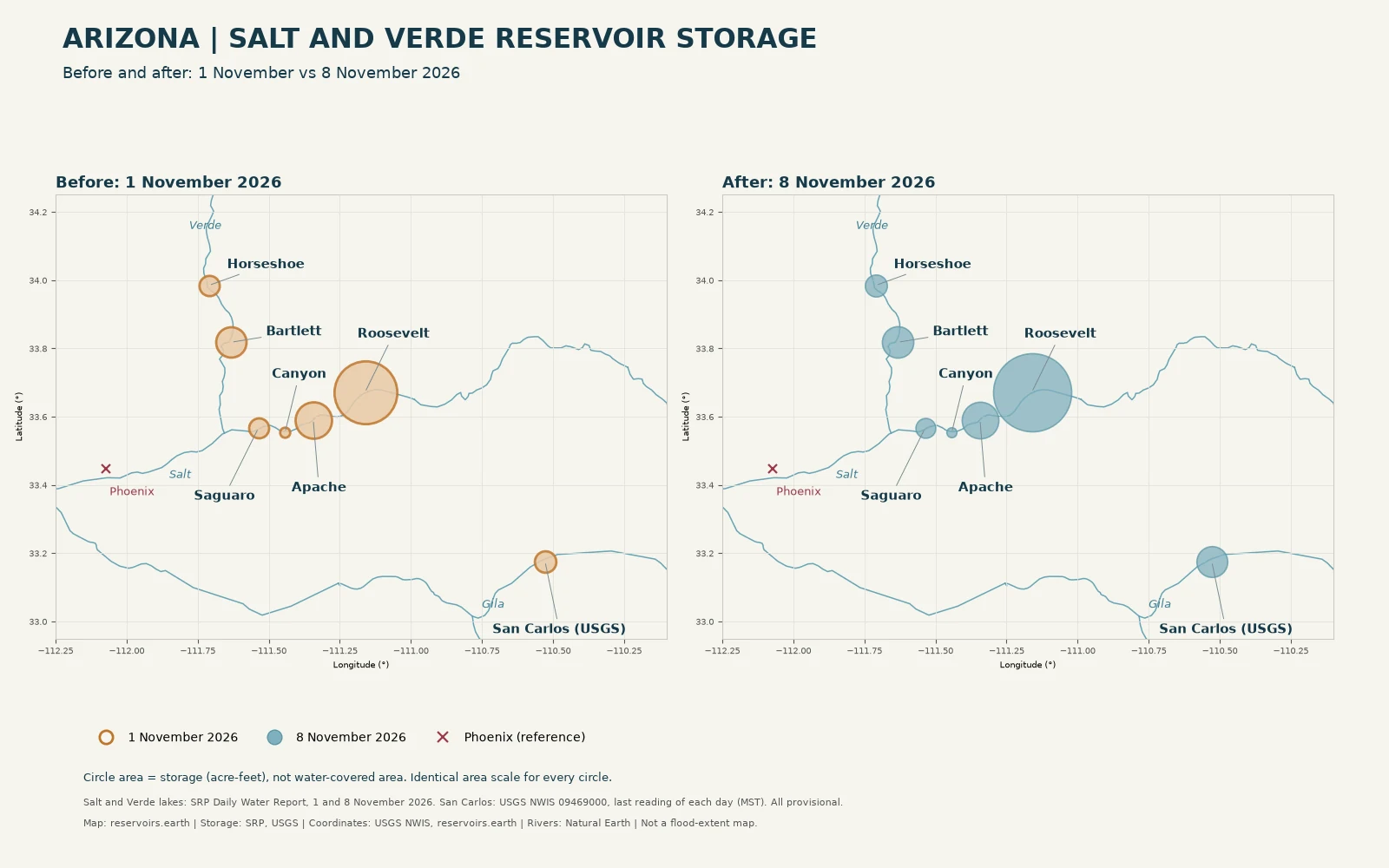
Original data visualisation, not shoreline photography. Circle area represents official storage in acre-feet: SRP Daily Water Report for 1 and 8 November 2026 for the six Salt and Verde lakes; USGS NWIS site 09469000, last reading of each day (MST), for San Carlos. All observations are provisional. Rivers are geographic reference lines from Natural Earth. The circles do not show flood extent or a reservoir footprint.
Salt River chain: Roosevelt, Apache, Canyon and Saguaro
Storage in acre-feet, with SRP's own % full in brackets. Each column is one dated Daily Water Report, November 2026.
| Reservoir (dam) |
1 Nov |
6 Nov |
8 Nov |
| Roosevelt Lake (Roosevelt) |
677,992 (41%) |
1,036,446 (63%) |
1,048,417 (64%) |
| Apache Lake (Horse Mesa) |
227,902 (93%) |
230,611 (94%) |
230,650 (94%) |
| Canyon Lake (Mormon Flat) |
17,422 (30%) |
16,970 (29%) |
17,171 (30%) |
| Saguaro Lake (Stewart Mountain) |
68,326 (98%) |
67,476 (97%) |
67,449 (97%) |
SRP gives Roosevelt's elevation as 2,094.40 feet on 1 November and 2,120.26 feet on 8 November. The percentages are SRP's labelled values. They are not recalculated here.
Verde River: Horseshoe and Bartlett
Same reports and units as the table above.
| Reservoir (dam) |
1 Nov |
6 Nov |
8 Nov |
| Horseshoe Lake (Horseshoe) |
70,522 (65%) |
85,758 (79%) |
83,058 (76%) |
| Bartlett Lake (Bartlett) |
158,395 (89%) |
166,398 (93%) |
169,684 (95%) |
Horseshoe held more on 6 November than on 8 November. The 8 November report lists a Horseshoe release of 2,250 cfs. These two observations do not by themselves explain SRP's operating decisions.
System totals (SRP)
SRP's own aggregates from the same dated reports, in acre-feet with SRP's % full.
| SRP aggregate |
1 Nov |
6 Nov |
8 Nov |
| Total Salt system |
991,642 (49%) |
1,351,503 (67%) |
1,363,687 (68%) |
| Total Verde system |
228,917 (80%) |
252,156 (88%) |
252,742 (88%) |
| Total Reservoir System |
1,220,559 (53%) |
1,603,659 (70%) |
1,616,429 (71%) |
| Total system a year ago (SRP %) |
54% |
54% |
54% |
For a quieter baseline before the storms, the report dated 20 October 2026 shows the Total Reservoir System at 1,157,092 acre-feet (50%), with Roosevelt at 637,829 acre-feet (39%).
San Carlos Reservoir (Gila): USGS, not SRP
San Carlos Reservoir, behind Coolidge Dam on the Gila River, is not part of SRP's system and is not on the Daily Water Report. Its storage comes from the US Geological Survey, site 09469000 ("San Carlos Reservoir at Coolidge Dam, AZ"), parameter 00054, reservoir storage in acre-feet. USGS marks the readings provisional.
| USGS reading (MST) |
Storage (acre-feet) |
| 1 November 2026, 23:45 |
79,080 |
| 6 November 2026, 23:45 |
152,500 |
| 8 November 2026, 23:45 |
163,200 |
The 8 November reading at 23:45 MST is 07:45 Europe/Madrid on 9 November. USGS publishes no % full in this series, so none is given.
The Colorado River for contrast
SRP's release notes that, unlike the Colorado River system, which has faced shortages in the ongoing drought, the Salt and Verde systems are "nearly in balance". KJZZ reported on 4 November that the rains were "quite literally a drop in the bucket" for Colorado River storage, quoting Nolie Templeton of the Central Arizona Project. For those reservoirs, see Lake Mead water level and Lake Powell water level.
Sources and methodology
Sources checked on 9 November 2026, between 08:58 and 09:10 Europe/Madrid:
- SRP Daily Water Report (Watershed Connection), dated reports for 20 October, 1 November, 6 November and 8 November 2026. The current report was dated 8 November at the time of checking. The report for 9 November had no figures yet.
- SRP news release, 6 November 2026: system percentages, the stored-volume estimate, peak inflows and release rates, all quoted as SRP's figures.
- USGS NWIS, site 09469000, parameter 00054, instantaneous values from the USGS water services API. The comparison uses the last reading of each calendar day in MST.
- KJZZ, 4 November 2026: Colorado River context only.
SRP states that the report "is subject to revision", and USGS marks its readings provisional. Storage is shown as published, to the nearest acre-foot. We do not calculate fill percentages, differences for a change column, projected dates or distance to full. A change in storage is not the same as storm inflow volume, flood damage avoided or water available for delivery. The maps do not show flood extent or current shoreline.
Map coordinates: USGS NWIS site records for Horseshoe, Bartlett and San Carlos; reservoirs.earth reservoir records for the four Salt River lakes. Rivers: Natural Earth.
This is general information from provisional agency reports, not legal, engineering or emergency advice. Follow current local authority and National Weather Service instructions for safety decisions.
Cite this page: reservoirs.earth, "Arizona's November 2026 Floods: How Much Water Reached the Salt and Verde Reservoirs", data as of 8 November 2026 (SRP) and 9 November 2026, 07:45 Europe/Madrid (USGS), https://reservoirs.earth/the-reservoir/arizona-floods-salt-verde-reservoir-storage-november-2026.
Related: Arizona reservoir levels, July 2026 · Arizona state data · New Mexico floods: reservoir storage before and after · Roosevelt Lake · Bartlett Reservoir · San Carlos Reservoir
Live fill levels
These widgets show each reservoir's current reading on reservoirs.earth. They update with the site's daily data and may differ from the dated figures above.
Roosevelt Lake reservoir level · data by reservoirs.earth
Apache Lake reservoir level · data by reservoirs.earth
Canyon Lake reservoir level · data by reservoirs.earth
Saguaro Lake reservoir level · data by reservoirs.earth
Horseshoe Reservoir reservoir level · data by reservoirs.earth
Bartlett Reservoir reservoir level · data by reservoirs.earth
San Carlos Reservoir reservoir level · data by reservoirs.earth