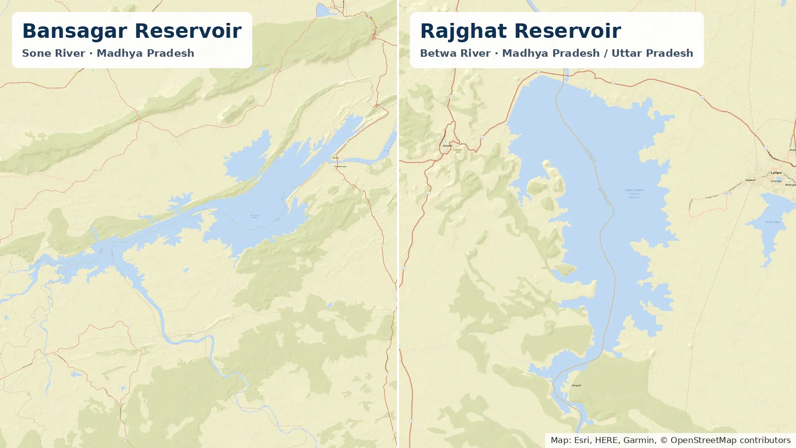
The Bansagar Agreement of 16 September 1973 shares the Sone river between Madhya Pradesh, Uttar Pradesh and Bihar on an annual flow of 14.25 M.A.F. (million acre feet): 5.25 M.A.F. for Madhya Pradesh, 7.75 M.A.F. for Bihar and 1.25 M.A.F. for Uttar Pradesh. When the flow is higher or lower, the use of Sone water is cut or increased pro rata in the proportion "5.25: 2.75: 1.25 for Madhya Pradesh, Bihar and Uttar Pradesh respectively", after 5 M.A.F. for old irrigation under the Sone barrage is deducted first. Rajghat Dam on the Betwa works differently: under the Betwa River Board Act, 1976, its cost and benefits are shared equally by Madhya Pradesh and Uttar Pradesh, and no official source found states a volume split or a shortage rule. For the latest readings, see our Bansagar Dam water level today and Rajghat Dam water level today pages.
Quick answer: Bansagar water belongs to three States under a 1973 agreement with fixed volumes in M.A.F. and a written pro-rata rule for wet and dry years. Rajghat water belongs to two States under an Act of Parliament that splits the project's cost and benefits equally. Each dam has a board chaired by a Union Minister: the one in charge of irrigation for Bansagar, and the Minister of Water Resources for Rajghat.
Sources as of: official pages and texts read on 18 November 2026. Storage figures are from our data pages, latest reading 29 October 2026.
Two shared dams, two legal instruments
Bansagar and Rajghat: how the water is shared, as stated in official sources
| Dam | River | States | Legal instrument | How the water is shared | Rule in a dry year |
|---|
| Bansagar | Sone | Madhya Pradesh, Uttar Pradesh, Bihar | Bansagar Agreement, 16 September 1973; Bansagar Control Board, Resolution of 30 January 1976, amended 28 March 1990 | Sone allocation of 5.25 M.A.F. (MP), 1.25 M.A.F. (UP) and 7.75 M.A.F. (Bihar); Bansagar storage of 2.0, 1.0 and 1.0 M.A.F. respectively | Pro-rata cut or increase against 14.25 M.A.F., in the proportion 5.25: 2.75: 1.25 for MP, Bihar and UP, after 5 M.A.F. for old Sone barrage irrigation |
|---|
| Rajghat | Betwa | Madhya Pradesh, Uttar Pradesh | Inter-state agreement of 1973; Betwa River Board Act, 1976 (Act No. 63 of 1976) | Cost and benefits of the dam and powerhouse shared equally; irrigation of 1.38 lakh ha in UP and 1.21 lakh ha in MP | Not stated |
|---|
Bansagar: the 1973 agreement on the Sone
The agreement was signed in New Delhi on 16 September 1973 by Abdul Gafoor, Chief Minister of Bihar, P.C. Sethi, Chief Minister of Madhya Pradesh, and Akbar Ali Khan, Governor of Uttar Pradesh. Its full text is published by the Bansagar Control Board and was laid before the Lok Sabha as Annexure-I to the answer to Unstarred Question No. 3607 of 26 April 2012.
Who gets what
Sone water under the Bansagar Agreement, as stated in the agreement (M.A.F.)
| State | Allocation from the Sone | Storage in Bansagar Project | Other components named in the text |
|---|
| Madhya Pradesh | 5.25 | 2.0 | 1.0 M.A.F. upstream of Bansagar; 2.25 M.A.F. in the Sone basin downstream of the dam |
|---|
| Uttar Pradesh | 1.25 | 1.0 | 0.25 M.A.F. from the Kanhar river; up to 1.0 M.A.F. from the dam and by lifting from the Sone downstream |
|---|
| Bihar | 7.75 | 1.0 | Irrigation requirement accepted as 8.00 M.A.F.; about 0.25 M.A.F. to be supplemented by pumping from the Ganga |
|---|
The figures are copied from paragraphs 2 to 5 of the agreement. For Uttar Pradesh, the agreement says "The Government of U.P. will decide the relative proportions of the use of this later 1.0 M.A.F."
Madhya Pradesh may also develop power at the foot of the dam, in the lower reaches of the Sone in its territory, and at Chachai Falls "making use of the diverted waters, which are intended, eventually for irrigation".
The pro-rata rule for wet and dry years
Paragraph 8 of the agreement, in full as published:
If the annual flow in the river is less or more than 14.25 M.A.F. there will be pro-rata cut or increase in the use of Sone Waters by the three States in proportion to the allocation for the various States as above, after deducting requirements of old irrigation under the Sone barrage, assessed at 5 M.A.F. which will receive water as a priority. The proportion of cut or increase would, therefore, be 5.25: 2.75: 1.25 for Madhya Pradesh, Bihar and Uttar Pradesh respectively.
Two points follow from the wording, not from any calculation. The ratio is listed in the order Madhya Pradesh, Bihar, Uttar Pradesh, which is not the order used elsewhere in the agreement. And the Bihar term in the ratio is 2.75, not Bihar's full 7.75 M.A.F. allocation, because the 5 M.A.F. for old Sone barrage irrigation "will receive water as a priority" before the cut or increase applies.
The Ministry of Water Resources gave the same rule to the Lok Sabha on 26 April 2012: "If the annual flow in river is less or more than 14.25 million acre feet (M.A.F.), there will be pro-rata cut or increase. The proportion of cut or increase would be 5.25 : 2.75 : 1.25 for Madhya Pradesh, Bihar and Uttar Pradesh respectively."
Who regulates the reservoir
Paragraph 7 of the agreement says "Rules for regulation of filling and use of Bansagar Reservoir will be drawn up by a committee consisting of Chairman, Central Water and Power Commission, and Chief Engineer of Irrigation of the three States." Whether those rules have been published: not stated on the Board's site.
The Bansagar Control Board was set up by Government of India, Ministry of Agriculture and Irrigation Resolution No. 8/17/74-DW-II of 30 January 1976, amended by Resolution No 18/17/74-DW-II of 28 March 1990, "in accordance with" the 1973 agreement, according to the Board. Its role was the "efficient, economical and early execution of Bansagar dam including all connected works in Madhya Pradesh, but excluding the canal systems", which each State builds.
- Board. Chaired by the "Union Minister In-charge of Irrigation". Members include the Union Minister in charge of Power and the Chief Ministers, Finance Ministers and Irrigation Ministers of Madhya Pradesh, Bihar and Uttar Pradesh (composition). The Department of Water Resources describes the Chairman as the Union Minister of Water Resources.
- Executive Committee. Chaired by the Chairman of the Central Water Commission, it manages the Board's affairs (composition).
- Water during construction. Among its functions, the Board decides "the withdrawals of water from the reservoir during the construction period for irrigation and power purpose".
- Secretariat. At Rewa, according to the Department of Water Resources.
Cost sharing: 2:1:1
The agreement shares the cost of Bansagar, including rehabilitation, "approximately in proportion to the water at the site to be utilized by the three States", that is "2:1:1 i.e. 50%, 25% and 25%". The Board's summary names the order: Madhya Pradesh, Uttar Pradesh and Bihar. The Department of Water Resources says the three States "share the cost and benefits from the Bansagar Dam in the ratio 2:1:1", and that the Board's office expenditure is reimbursed "in equal proportions".
Bihar's releases, 2006-07 to 2010-11
The 2012 Lok Sabha answer gave the year-wise releases from Bansagar Dam for Bihar. The figures are copied as published, in million cubic metres.
Bansagar Dam releases for Bihar, as given to the Lok Sabha on 26 April 2012 (M Cum)
| Year | Total storage | Bihar share (1/4th of total storage) | Quantity of water released |
|---|
| 2006-07 | 4220.552 | 1055.138 | 1081.932 |
|---|
| 2007-08 | 2357.954 | 589.488 | 522.139 |
|---|
| 2008-09 | 2772.891 | 693.222 | 850.746 |
|---|
| 2009-10 | 2148.964 | 537.241 | 525.799 |
|---|
| 2010-11 | 2776.963 | 694.240 | 699.475 |
|---|
The answer says the releases were made "as per their demand received from time to time". Releases after 2010-11 are not stated in any official source found.
Rajghat: the Betwa River Board Act, 1976
This section covers the Rajghat Dam on the Betwa, shown on our Rajghat data page at 24.733°N, 78.167°E. Any other dam with the same name is not covered here.
According to the Department of Water Resources, the Rajghat Dam Project on the Betwa, a tributary of the Yamuna, is an inter-state project of Madhya Pradesh and Uttar Pradesh. The Betwa River Board was constituted under the Betwa River Board Act, 1976, "in accordance with" an inter-state agreement reached between the two States in 1973.
The Betwa River Board gives the background:
- 22 July 1972. A meeting between the Chief Ministers of Uttar Pradesh and Madhya Pradesh decided to harness the water resources of the Betwa.
- 9 December 1973. The two States agreed to set up "a tripartite Control Board" for the execution of their inter-state projects.
- 1976. The Board was constituted by an Act of Parliament, under the chairmanship of the Union Minister of Water Resources, to execute the Rajghat Dam Project and Power House.
What the Act says
The Betwa River Board Act, 1976, as recorded by India Code
| Act number | 63 of 1976 |
|---|
| Enactment date | 10 April 1976 |
|---|
| In force from | 25 October 1976, notification No. G.S.R. 1518(E) of 14 October 1976 |
|---|
| Long title | "An Act to provide for the establishment of a Board for the creation of a reservoir at Rajghat by construction, on behalf of the Governments of Madhya Pradesh and Uttar Pradesh, of a dam on the Betwa river at Rajghat and for the regulation of such reservoir." |
|---|
| Administering department | Department of Water Resources, River Development and Ganga Rejuvenation, Ministry of Jal Shakti |
|---|
| Relevant sections | Section 10, Functions of the Board; Section 11, Conditions subject to which the Board may exercise its functions; Section 12, Powers of the Board; Section 18, Disputes between the Board and the State Governments |
|---|
The Betwa River Board (Amendment) Act, 1993 (No. 49 of 1993) replaced the words "Rajghat Reservoir" with "Rani Laxmibai Sagar" in sections 3 and 12 of the Act, and provides that any reference to Rajghat Reservoir in another law or document "shall be construed as a reference to Rani Laxmibai Sagar" (India Code).
How the cost and benefits are shared
The Department of Water Resources states that "the cost and benefits of the dam and the powerhouse are to be shared equally by the states of Uttar Pradesh and Madhya Pradesh". The project is paid for from the Betwa River Board Fund, made up of the two States' contributions. The Board built the dam and powerhouse civil works; each State builds the canals in its own territory. The Department says the dam works have been completed.
The Betwa River Board gives the irrigation planned under the project as 1.38 lakh ha in Uttar Pradesh and 1.21 lakh ha in Madhya Pradesh.
The Board and its rules
The Board is chaired by the Union Minister of Water Resources. Its members are the Union Minister of Power, the Union Minister of State for Water Resources, and the Chief Ministers and Ministers in charge of Finance, Irrigation and Power of Uttar Pradesh and Madhya Pradesh, according to the Department of Water Resources. The Board's headquarters is at Jhansi, with subordinate offices at Rajghat.
The Betwa River Board Rules, as amended by notification of 31 December 1979, say Board decisions are taken by majority vote of members present and voting. Where the Chairman is satisfied that there is a difference of opinion "on any question of policy or the rights of any of the Governments of Madhya Pradesh and Uttar Pradesh", the matter goes to the Central Government, "whose decision thereon shall be final".
Shortage rule
A volume split of Betwa water at Rajghat, or a rule for cutting releases when storage is low: not stated in any official source read for this article.
Current storage on our data pages
These are the latest readings on our data pages, which are built from Central Water Commission (CWC) figures. Both readings are older than the 14-day window our pages use, so the pages mark them as stale.
No figure here is a calculation. The legal allocations above are in M.A.F. and are not converted.
What is not stated
- Whether the 1973 pro-rata rule has been applied in any given water year, and with what flow figure: not stated in the sources read.
- The reservoir regulation rules provided for in paragraph 7 of the Bansagar Agreement: not stated (not published on the Bansagar Control Board site).
- Bansagar releases to Bihar after 2010-11: not stated.
- A volume allocation or a shortage rule for Rajghat: not stated.
- The text of the 1972 and 1973 Betwa decisions themselves: not published on the official pages read.
Other water-sharing rules
The Tungabhadra water sharing article covers the KWDT award and the Tungabhadra Board's proportional reduction rule. The Krishna water sharing at Srisailam article covers the Krishna River Management Board. State thresholds across India are in India water restriction thresholds.
Sources and methodology
Sources checked on 18 November 2026, between 09:20 and 10:00 Europe/Madrid:
- Bansagar Control Board, Agreement of Bansagar Project, dated 16 September 1973 (allocations, pro-rata rule, cost sharing, regulation committee).
- Bansagar Control Board, About us, Composition of BCB, Composition of the Executive Committee and Functions.
- Lok Sabha, Unstarred Question No. 3607, "Bansagar Agreement", answered on 26 April 2012 by the Minister of State for Water Resources, with the agreement as Annexure-I. 15th Lok Sabha, Session 10, on Digital Sansad, Questions and Answers.
- Department of Water Resources, River Development and Ganga Rejuvenation, Ministry of Jal Shakti: Bansagar Control Board and Betwa River Board. The Betwa page was read in its Hindi version; the English text on jalshakti-dowr.gov.in says the same.
- Betwa River Board, About us (1972 and 1973 decisions, equal sharing, irrigation by State). The site did not respond from our server on 18 November 2026; its text was checked as indexed.
- India Code, The Betwa River Board Act, 1976 (Act number, dates, notification, long title, section headings), the Betwa River Board (Amendment) Act, 1993 and the Betwa River Board Rules. India Code returned HTTP 504 to our server on 18 November 2026; these records were checked as indexed.
- reservoirs.earth data pages for Bansagar and Rajghat, built from CWC figures. See also how we get our data for India.
Units are as published: M.A.F. in the agreement and the Lok Sabha answer, M Cum in the 2012 release table, MCM on our data pages. No figure has been converted, added or subtracted in the text.
This article sets out the water-sharing rules as published in the official texts and pages listed above, on the dates stated. reservoirs.earth is not affiliated with any government body. It is general information, not legal advice. Where this page and an official text differ, the official text prevails.
Cite this page: reservoirs.earth, "Who Owns the Water at Bansagar and Rajghat? The Interstate Agreements Behind Central India's Shared Dams", sources as of 18 November 2026, https://reservoirs.earth/the-reservoir/bansagar-rajghat-interstate-water-sharing.
Related: Bansagar Dam water level today · Rajghat Dam water level today · Madhya Pradesh reservoir levels · India reservoir levels
Live fill levels
These widgets show each reservoir's current reading on reservoirs.earth. They update with the site's daily data and may differ from the dated figures above.
Bansagar Dam water level · data by reservoirs.earth
Rajghat Dam water level · data by reservoirs.earth