Reservoir · Andhra Pradesh · India · AP-WRIMS
Mopadu Reservoir Project
Gross capacity
2.1 TMC (59 MCM)
Live capacity
2.0 TMC (58 MCM)
Basin
Other
Operator
AP Water Resources Dept
Coordinates
15.106°N, 79.482°E
Last updated
2026-10-25
Capacity in TMC
Mopadu Reservoir Project has a gross capacity of 2.1 TMC (59 MCM), of which 2.0 TMC (58 MCM) is live storage.
- Gross capacity
- 2.1 TMC (59 MCM)
- Live capacity
- 2.0 TMC (58 MCM)
- Current storage
- 0.00 TMC (0 MCM)
TMC is thousand million cubic feet, the unit used in Indian water reporting. 1 TMC = 28.3168 million cubic metres (MCM). Figures are converted from AP-WRIMS, which publishes million cubic metres. The percentage is labelled live or gross only when the stored volume matches that capacity.
Current fill
0.0%vs 7 days ago
N/Avs 1 year ago
N/A7-day trend
N/ADrought context
Rain over the last three months · 11 October 2026
Severely dry
In the three months to 11 October 2026 the area around Mopadu Reservoir Project had far less rain than normal, a shortfall seen about one year in fifteen. Rainfall compared with the long-run record for the same season at this point (Copernicus Global Drought Observatory, SPI-3 index −1.75). Rain, not storage. India drought figures →
Weekly storage
Fill history — multi-year
About this reservoir
Data source
official
Storage data: AP-WRIMS.
Catchment Weather
Past 30 days + 14-day forecast · Open-Meteo
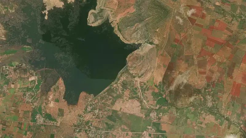
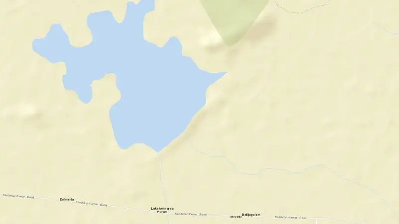
Satellite imagery: Esri, Maxar, Earthstar Geographics. Map: Esri, HERE, Garmin, © OpenStreetMap contributors. 15.106°N, 79.482°E · Open in Google Maps
About Mopadu Reservoir Project
As of October 25, 2026, Mopadu Reservoir Project is at 0.0% of useful capacity, holding 0.00 TMC (0 MCM) of 2.0 TMC (58 MCM). Of the gross 2.1 TMC (59 MCM), that is 0.0%. At this level the reservoir is critically low.
No reading from about a week earlier is on file, so the 7-day change is not available.
Across the readings we hold for Mopadu Reservoir Project — 1 data points between October 25, 2026 and October 25, 2026 — the level has ranged from a low of 0.0% (October 25, 2026) to a high of 0.0% (October 25, 2026).
It is operated by AP Water Resources Dept. It lies within the Other basin at 15.106°N, 79.482°E.
Key facts
- Current fill level
- 0.0% of useful capacity
- Water stored
- 0.00 TMC (0 MCM)
- Total capacity
- 2.1 TMC (59 MCM)
- Usable capacity
- 2.0 TMC (58 MCM)
- 7-day change
- N/A
- River basin
- Other
- Operator
- AP Water Resources Dept
- Coordinates
- 15.106°N, 79.482°E
- Last updated
- October 25, 2026
Recent readings
| Date | Fill level | Volume (hm³) |
|---|---|---|
| 25 Oct 2026 | 0.0% | 0 |