Reservoir · South Australia · Australia · BOM Water Data Online
Lock 2 - Waikerie
67.6% full
Capacity
40.4 hm³
Volume stored
27 hm³
River
River Murray
Year completed
1928
Coordinates
34.084°S, 139.949°E
Last updated
2026-07-28
Current fill
67.6%vs 7 days ago
-0.1%losing
vs 1 year ago
+0.5%year-over-year
7-day trend
→stable
Data source: Bureau of Meteorology — Water Data Online (KiWIS) — daily mean storage volume, quality-controlled. Capacity from the BOM Water Storages ArcGIS layer (total design capacity in ML). Last reading: 2026-07-28.
Catchment Weather
Past 30 days + 14-day forecast · Open-Meteo
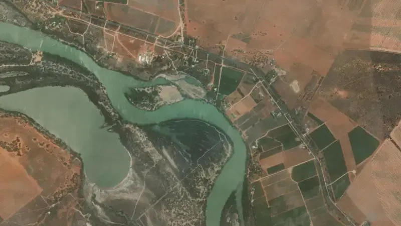
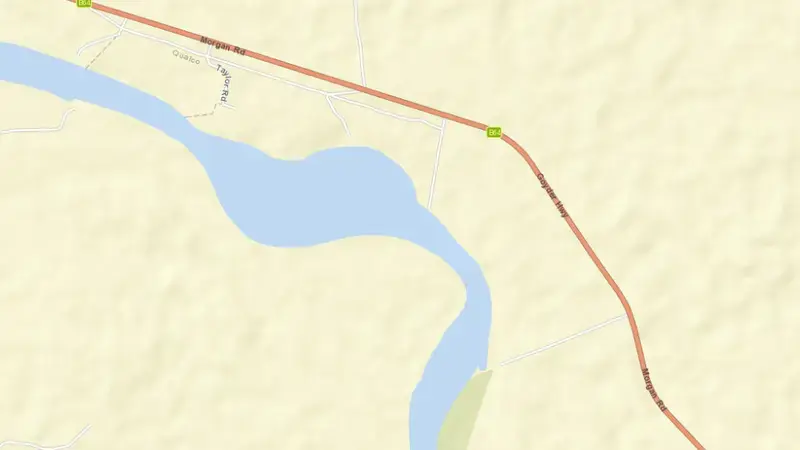
Satellite imagery: Esri, Maxar, Earthstar Geographics. Map: Esri, HERE, Garmin, © OpenStreetMap contributors. -34.084, 139.949 · Open in Google Maps
About Lock 2 - Waikerie
As of July 28, 2026, Lock 2 - Waikerie is filled to 67.6% of its total capacity, holding roughly 27 hm³ of water out of a maximum 40 hm³. At this level the reservoir is within its normal operating range. Of that total, about 27 hm³ is usable (live) storage.
Over the most recent week on record the fill level has held broadly steady (-0.1 pts), and it sits close to where it was a year earlier.
Across the readings we hold for Lock 2 - Waikerie — 1095 data points between July 30, 2023 and July 28, 2026 — the level has ranged from a low of 64.6% (November 30, 2023) to a high of 80.1% (September 28, 2025). On average the reservoir is fullest around September and at its lowest around July.
The dam at Lock 2 - Waikerie was completed in 1928. It is operated by BOM primarily for water supply. It lies within the River Murray Basin basin at 34.084°S, 139.949°E.
Key facts
- Current fill level
- 67.6%
- Water stored
- 27 hm³
- Total capacity
- 40 hm³
- Usable capacity
- 27 hm³
- 7-day change
- ▼ 0.1 pts
- Year-on-year
- ▲ 0.5 pts
- Primary use
- Water supply
- River
- River Murray
- River basin
- River Murray Basin
- Year completed
- 1928
- Operator
- BOM
- Coordinates
- 34.084°S, 139.949°E
- Last updated
- July 28, 2026
Recent readings
| Date | Fill level | Volume (hm³) |
|---|---|---|
| 28 Jul 2026 | 67.6% | 27 |
| 27 Jul 2026 | 67.7% | 27 |
| 26 Jul 2026 | 67.6% | 27 |
| 25 Jul 2026 | 67.5% | 27 |
| 24 Jul 2026 | 67.5% | 27 |
| 23 Jul 2026 | 67.3% | 27 |
| 22 Jul 2026 | 67.3% | 27 |
| 21 Jul 2026 | 67.1% | 27 |
| 20 Jul 2026 | 67.2% | 27 |
| 19 Jul 2026 | 67.3% | 27 |
| 18 Jul 2026 | 67.3% | 27 |
| 17 Jul 2026 | 67.3% | 27 |
Frequently asked questions
What is the current water level of Lock 2 - Waikerie?
As of July 28, 2026, Lock 2 - Waikerie is at 67.6% of its capacity, holding approximately 27 hm³ of water, according to BOM data.
Is Lock 2 - Waikerie reservoir full?
No. As of July 28, 2026, Lock 2 - Waikerie is within its normal operating range at 67.6% of its capacity, so it is not full.
Is the water level at Lock 2 - Waikerie rising or falling?
The level at Lock 2 - Waikerie has been broadly stable over the latest week on record (-0.1 points).
How much water can Lock 2 - Waikerie hold?
Lock 2 - Waikerie has a total capacity of 40 hm³, of which about 27 hm³ is usable storage.
Where is Lock 2 - Waikerie reservoir located?
Lock 2 - Waikerie is located in South Australia, Australia, within the River Murray Basin basin (coordinates 34.084°S, 139.949°E).
When was Lock 2 - Waikerie dam built?
The dam at Lock 2 - Waikerie was completed in 1928.
What is Lock 2 - Waikerie used for?
Lock 2 - Waikerie is used primarily for water supply, and is managed by BOM.