Agrio (Aznalcollar)
Guadalquivir
Capacity
20 hm³
Coordinates
37.536°N, 6.293°W
Operator
Guadalquivir
75.0% full
Current fill
75.0%vs 13 Oct 2026
-5.0 pplosing
vs 1 year ago
+35.0 ppyear-over-year
Trend
↓falling
Drought context
Storage vs October average
128%of normal
75.0% full on 2026-10-19, against an average of 58.5% for October across 9 years of readings (+16.5 points).
Rain over the last three months · 11 October 2026
Moderately dry
In the three months to 11 October 2026 the area around Agrio (Aznalcollar) had well below normal rain, a shortfall seen about one year in six. Rainfall compared with the long-run record for the same season at this point (Copernicus Global Drought Observatory, SPI-3 index −1.33). Rain, not storage.
EU drought indicator · 11 October 2026
Alertvegetation stress
The European Drought Observatory's combined reading of rain, soil moisture and vegetation at this point. Watch means rain has been short, Warning that the soil has dried out, Alert that vegetation is visibly stressed; Recovery means the shortfall is easing. Ground conditions, not the reservoir's storage. Spain drought figures →
Catchment Weather
Past 30 days + 14-day forecast · Open-Meteo
Technical specifications
| Total capacity | 20 hm³ |
| Primary use | — |
| Operator | Guadalquivir |
| River basin | Guadalquivir |
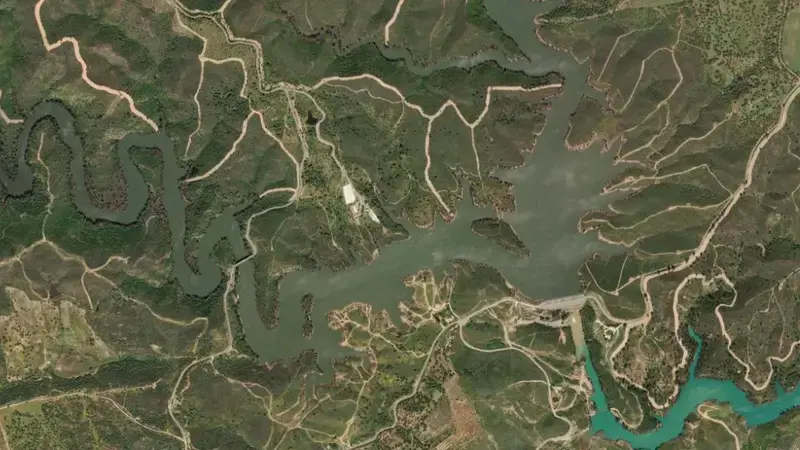
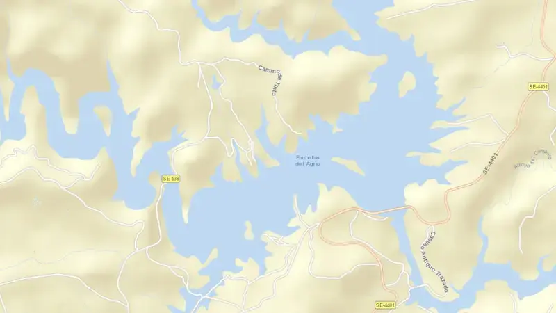
Satellite imagery: Esri, Maxar, Earthstar Geographics. Map: Esri, HERE, Garmin, © OpenStreetMap contributors. 37.536°N, 6.293°W · Open in Google Maps
About Agrio (Aznalcollar)
As of October 19, 2026, Agrio (Aznalcollar) is filled to 75.0% of its total capacity, holding 15 hm³ of water out of a maximum 20 hm³. At this level the reservoir is within its normal operating range.
Since October 13, 2026 the fill level has fallen by 5.0 percentage points, and it is 35.0 points above its level on the same date a year earlier.
Across the readings we hold for Agrio (Aznalcollar) — 419 data points between October 16, 2018 and October 19, 2026 — the level has ranged from a low of 30.0% (September 21, 2021) to a high of 100.0% (February 13, 2024). On average the reservoir is fullest around April and at its lowest around October.
It is operated by Guadalquivir. It lies within the Guadalquivir basin at 37.536°N, 6.293°W.
Key facts
- Current fill level
- 75.0% of total capacity
- Water stored
- 15 hm³
- Total capacity
- 20 hm³
- Change since October 13, 2026
- ▼ 5.0 pp
- Year-on-year
- ▲ 35.0 pp
- River basin
- Guadalquivir
- Operator
- Guadalquivir
- Coordinates
- 37.536°N, 6.293°W
- Last updated
- October 19, 2026
Recent readings
| Date | Fill level | Volume (hm³) |
|---|---|---|
| 19 Oct 2026 | 75.0% | 15 |
| 13 Oct 2026 | 80.0% | 16 |
| 6 Oct 2026 | 80.0% | 16 |
| 29 Sep 2026 | 80.0% | 16 |
| 22 Sep 2026 | 80.0% | 16 |
| 15 Sep 2026 | 80.0% | 16 |
| 8 Sep 2026 | 80.0% | 16 |
| 1 Sep 2026 | 80.0% | 16 |
| 25 Aug 2026 | 80.0% | 16 |
| 18 Aug 2026 | 85.0% | 17 |
| 11 Aug 2026 | 85.0% | 17 |
| 4 Aug 2026 | 85.0% | 17 |