Reservoir · Tamil Nadu · India · CWC
Mirugandanadhi
Total capacity
2 hm³
Live storage
2 hm³
River
Palar
Basin
Palar
Primary use
irrigation
Operator
Tamil Nadu Water Resources Dept
Coordinates
12.490°N, 78.945°E
Fill history — multi-year
About this reservoir
Data source
official
Storage data: CWC (Central Water Commission) Weekly Storage Bulletin, India.
Catchment Weather
Past 30 days + 14-day forecast · Open-Meteo
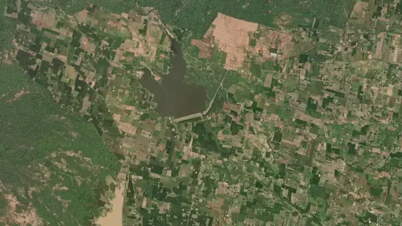
Satellite imagery: Esri, Maxar, Earthstar Geographics. Map: Esri, HERE, Garmin, © OpenStreetMap contributors. 12.490, 78.945 · Open in Google Maps
About Mirugandanadhi
It is operated by Tamil Nadu Water Resources Dept primarily for irrigation. It lies within the Palar basin at 12.490°N, 78.945°E.
Key facts
- Total capacity
- 2 hm³
- Primary use
- Irrigation
- River
- Palar
- River basin
- Palar
- Operator
- Tamil Nadu Water Resources Dept
- Coordinates
- 12.490°N, 78.945°E
Recent readings
| Date | Fill level | Volume (hm³) |
|---|---|---|
| 1 Jun 2026 | 17.4% | 0 |
Frequently asked questions
How much water can Mirugandanadhi hold?
Mirugandanadhi has a total capacity of 2 hm³.
Where is Mirugandanadhi reservoir located?
Mirugandanadhi is located in Tamil Nadu, India, within the Palar basin (coordinates 12.490°N, 78.945°E).
What is Mirugandanadhi used for?
Mirugandanadhi is used primarily for irrigation, and is managed by Tamil Nadu Water Resources Dept.