
Reservoir · Andhra Pradesh · India · CWC
Kanigiri Reservoir
49.7% full
Gross capacity
3.5 TMC (98 MCM)
Live capacity
3.4 TMC (97 MCM)
River
Pennar
Basin
Pennar
Operator
AP Water Resources Dept
Coordinates
14.557°N, 79.870°E
Last updated
2026-09-10
Capacity in TMC
Kanigiri Reservoir has a gross capacity of 3.5 TMC (98 MCM), of which 3.4 TMC (97 MCM) is live storage; it is currently at 50% full, holding 1.7 TMC (49 MCM).
- Gross capacity
- 3.5 TMC (98 MCM)
- Live capacity
- 3.4 TMC (97 MCM)
- Current storage
- 1.7 TMC (49 MCM)
TMC is thousand million cubic feet, the unit used in Indian water reporting. 1 TMC = 28.3168 million cubic metres (MCM). Figures are converted from the Central Water Commission bulletin, which publishes million cubic metres.
Current fill
49.7%vs 7 days ago
0.0%stable
vs 1 year ago
N/A7-day trend
→stable
Weekly storage
Fill history — multi-year
About this reservoir
Data source
official
Storage data: CWC (Central Water Commission) Weekly Storage Bulletin, India.
Catchment Weather
Past 30 days + 14-day forecast · Open-Meteo
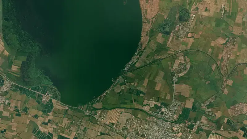
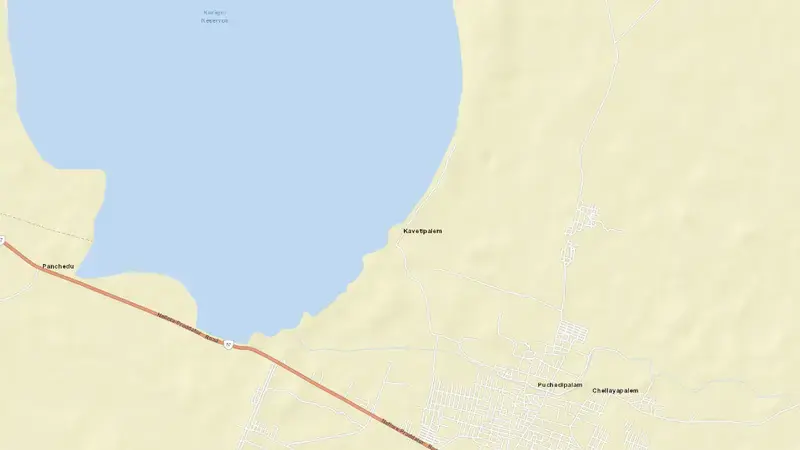
Satellite imagery: Esri, Maxar, Earthstar Geographics. Map: Esri, HERE, Garmin, © OpenStreetMap contributors. 14.557, 79.870 · Open in Google Maps
About Kanigiri Reservoir
As of September 10, 2026, Kanigiri Reservoir is filled to 49.7% of its total capacity, holding 1.7 TMC (49 MCM) of a gross 3.5 TMC (98 MCM). At this level the reservoir is within its normal operating range. Of that total, 3.4 TMC (97 MCM) is live storage.
Over the most recent week on record the fill level has held broadly steady (+0.0 pts).
Across the readings we hold for Kanigiri Reservoir — 1 data points between September 10, 2026 and September 10, 2026 — the level has ranged from a low of 49.7% (September 10, 2026) to a high of 49.7% (September 10, 2026).
It is operated by AP Water Resources Dept. It lies within the Pennar basin at 14.557°N, 79.870°E.
Key facts
- Current fill level
- 49.7%
- Water stored
- 1.7 TMC (49 MCM)
- Total capacity
- 3.5 TMC (98 MCM)
- Usable capacity
- 3.4 TMC (97 MCM)
- 7-day change
- No change
- River
- Pennar
- River basin
- Pennar
- Operator
- AP Water Resources Dept
- Coordinates
- 14.557°N, 79.870°E
- Last updated
- September 10, 2026
Recent readings
| Date | Fill level | Volume (hm³) |
|---|---|---|
| 10 Sep 2026 | 49.7% | 49 |